Editor’s Note: This is a long read about seeking out Rare Earth Materials – but it is useful to pick topics of interest…
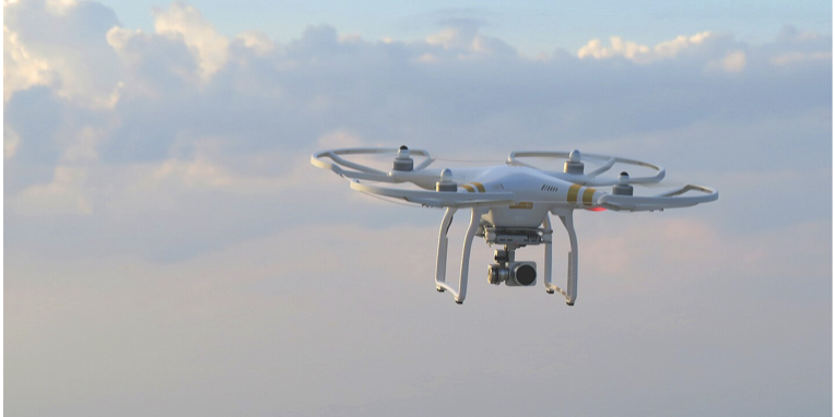
Early academic demonstrations around 2019–2020 showed drones could carry lightweight hyperspectral cameras and magnetometers to rapidly map REE‑bearing minerals at mine and prospect scale, bridging the resolution gap between fieldwork and manned airborne surveys. A widely cited highlight from Helmholtz/Siilinjärvi (Finland) and Namibia demonstrated direct mapping of REE spectral features with UAV hyperspectral platforms, achieving sub‑day turnarounds and detection limits for Nd <200 ppm—proof that drones can materially accelerate surface targeting in carbonatite and peralkaline systems.
Since then, industrial case studies have multiplied. MP Materials/University of Houston (Mountain Pass, USA) published 2024 results using UAV‑mounted Senop/Specim hyperspectral sensors to delineate bastnäsite distributions across pits and outcrops, validating with thin sections and geochem; this is one of the clearest peer‑reviewed links from drone imagery to REE host minerals at an operating site.
In parallel, Nature Reviews Earth & Environment summarized field deployments mapping REE‑rich minerals with drones in Namibia and magnetic UAV surveys in Greenland, both at a fraction of traditional costs and with finer spatial granularity.
The technical stack (and what really matters in REE)
Hyperspectral imaging (HSI) for surface mineralogy.
For REE, the targets are often bastnäsite, monazite, xenotime or REE‑bearing eudialyte. These host phases show diagnostic absorption features in VNIR/SWIR due to 4f‑electron transitions (Nd³⁺, Pr³⁺, Sm³⁺ in monazite; Dy³⁺, Er³⁺, Ho³⁺, Tb³⁺ in xenotime) plus carbonate/PO₄ features—drones flying 20–120 m AGL can sample hundreds of contiguous bands to classify minerals at centimeter–decimeter pixels.
Recent spectroscopy work (2024) strengthens the spectral libraries behind these classifications, clarifying which ions drive the main bands and how minor ligand effects shift wavelengths. Vendors like Specim (Finland) and HySpex (Norway) supply UAV‑sized sensors covering VNIR–SWIR (and sometimes LWIR), now standard in mining workflows from outcrop to drill core logging.
What it unlocks for REE: rapid mapping of carbonatite ring structures, alteration halos, and bastnäsite/monazite lenses, orthorectified to terrain using RTK/PPK GNSS and integrated with LiDAR for 3D context (pit walls, benches, talus). Where radiation permits and regulations allow, some teams combine UAS gamma spectrometry (thorium proxy) with SWIR to flag REE‑bearing carbonates, e.g., Bearpaw Mountains (MT) used UAS gamma + SWIR to define REE targets consistent with ground truth.
Drone magnetometry for structure and subsurface cues
REE deposits in carbonatites often carry magnetite/Fe‑rich phases or are associated with magnetic contrasts at intrusive contacts. UAVs carrying scalar magnetometers (e.g., Geometrics MagArrow, GEM Systems GSMP‑35U) fly tight lines (25–50 m spacing) and low altitudes (~20–50 m) to produce high‑resolution magnetic grids that surpass legacy regional data.
Examples include MTM Critical Metals’ Pomme carbonatite (Québec) where a drone magnetic survey at 25 m line spacing and ~22 m sensor height produced detailed models guiding drilling; and Power Minerals’ Santa Anna complex, where 385 line‑km at 50 m spacing resolved internal architectural features for targeting.
Platform suppliers such as Skyfront integrate long‑endurance hybrids with magnetometers and terrain following for large, rugged areas, and integrators like SPH Engineering provide mission planning/processing workflows (uGCS + processing toolchains) tailored to geophysics.
LiDAR and photogrammetry for geology in 3D
While LiDAR does not “see” REE, it is invaluable to strip vegetation, model contacts and fractures, and orthorectify hyperspectral mosaics, especially on steep faces. Service firms (e.g., Darling Geomatics) combine drone LiDAR and hyperspectral for rapid mine‑scale mineral mapping, including hazardous pit faces and legacy workings.
Software, AI, and multi‑sensor fusion
Academic consortia (e.g., M4Mining, MULSEDRO) and EU projects (AGEMERA) are pushing real‑time hyperspectral classification, small‑form multi‑sensor UAS, and web platforms that co‑visualize drone/satellite/passive seismic data for critical raw materials. The aim: edge processing, dynamic visualization, and fewer invasive samples during exploration and closure monitoring. In the U.S., DARPA/USGS efforts (CriticalMAAS; HyperSpectral partnership) are compressing mineral assessment timelines from years to days, combining AI with spectral/geologic data, work that explicitly targets REE and carbonatite/peralkaline systems.
Where it’s being used – notable regions, companies, and case studies
Operating and brownfield sites:
Mountain Pass (USA)
UAV hyperspectral mapping of bastnäsite distributions within pits; integration to guide selective mining.
Siilinjärvi (Finland) and Namibia
Feld‑proven UAV hyperspectral detection of REE minerals at mine/prospect scale (Helmholtz/Freiberg team).
Frontier carbonatites and alkaline complexes:
Greenland (Kvanefjeld/Kringlerne/Motzfeldt Sø; Sarfartoq etc.)
UAV magnetics and HSI cited as cost‑effective add‑ons to manned surveys in rugged terrain; strong geological context documented by GEUS.
Québec (Canada)
Pomme carbonatite drone mag guiding drill campaigns near Montviel.
Australia
UAV magnetics and ground radiometrics supporting REE/xenotime prospects in WA; national work mapping carbonatite potential underscores how magnetic “worms” and LIP margins correlate with REE districts (a pointer to where drones add value locally).
Service and tech providers
Specim, HySpex (hyperspectral sensors); SPH Engineering/uGCS, Geometrics/GEM Systems (magnetometry); Skyfront (long‑endurance UAS); Darling Geomatics, Drone Geoscience (multi‑sensor mapping); and Exyn/Flyability for underground imaging where mine geography limits surface access.
Practical implications – data quality, economics, ESG, and permitting
Resolution & targeting
Flying lower with tight line spacing yields centimeter–decimeter hyperspectral pixels and sub‑50 m magnetic line spacing, resolving thin dikes, ring fracturing, and alteration zonation that regional surveys miss; this often reduces blind drilling and positions teams to test the right structures first.
Cost & speed
UAV surveys can cut acquisition time and cost by orders of magnitude over manual traverses or helicopters, especially in steep, vegetated, or sensitive areas. Industry write‑ups and platform vendors consistently report faster missions, better economics, and safer ops, though results depend on terrain, wind, and airspace.
ESG & social license
The non‑invasive footprint matters in REE because many deposits sit near communities or sensitive watersheds. Drones support environmental monitoring (acid drainage, vegetation stress) and legacy mine re‑mining decisions without putting personnel at risk, an ESG‑friendly edge.
Limits & caveats
Payload capacity, magnetic noise from airframes, and regulatory constraints (VLOS/BVLOS, altitude, radiation in Th‑rich terrains) can constrain deployment. Fluxgate vs. scalar magnetometer choice, sensor standoff, and careful mission planning (tie‑lines, terrain following) are essential to clean data.
Strategic & geopolitical consequences – why drones for REE matter
Faster prospect maturation for non‑Chinese supply
Europe’s Critical Raw Materials Act (CRMA) sets targets for domestic extraction/processing/recycling by 2030, and the Commission has now selected 47 “Strategic Projects” and launched RESOURCEU to de‑risk and fast‑track permitting (27 months for extraction), fund projects, and even coordinate stockpiling. UAV exploration, with its speed and small footprint, directly serves these timelines and stakeholder expectations.
Greenland, Nordics, and the EU’s “interior frontiers.”
Greenland’s REE potential continues to draw attention, but permitting (uranium co‑extraction bans), infrastructure, and social license keep projects in flux; drones help de‑risk early stages, gathering high‑quality data without heavy machinery, useful in politically sensitive contexts. Meanwhile Norra Kärr (Sweden) has re‑emerged as a heavy REE anchor amid Europe’s Dy/Tb shortages; academic/policy analyses underscore how redesigned, lower‑footprint plans and faster sequencing still face community trust issues, precisely where transparent drone mapping and public‑facing monitoring can help.
U.S. strategic posture
DARPA/USGS initiatives to compress assessment timelines and apply AI to hyperspectral/geologic data are explicitly about improving domestic REE resilience, with drones as one of several platforms feeding the data pipeline. That focus, paired with industrial magnet supply chain concerns, signals that rapid, repeatable reconnaissance will be part of national security strategy.
Global competition and transparency
Beyond finding deposits, programs like DARPA’s OPEN target market transparency for critical materials, pricing, supply/demand forecasting. Faster, richer exploration data from drones feeds better market intelligence and reduces the likelihood of abrupt supply shocks.
Five trends to watch (2026–2035)
- Real-time, edge‑AI mineral classification.
Expect more on‑board classification (bastnäsite/monazite likelihood maps) and swarm UAS that iterate survey parameters in the field based on anomaly scores, M4Mining’s demos and EU projects point the way.
- Integrated gamma + hyperspectral + magnetics in one flight plan.
Pilot studies (Bearpaw) already combine UAS gamma spectroscopy with SWIR carbonate mapping; expect commercial systems that co‑register all three streams to produce REE target probability surfaces that directly guide drilling.
- BVLOS standardization and heavier payloads.
Projects like AGAVE (SkyTEM & partners) show regulators permitting large drones with external geophysical loads; as BVLOS becomes routine in more jurisdictions, district‑scale REE geoscanning will be feasible.
- From exploration to selective mining and re‑mining.
In active operations, hyperspectral drones will increasingly guide ore/waste discrimination, pit wall decisions, and tailings re‑mining for REE recovery, tight loops between mapping → sorting will reduce energy per tonne produced.
- Policy coupling: “fast‑track data” as a permitting asset.
Under CRMA/RESourceEU, drone‑based datasets, repeatable, open formats, clear QA/QC, will be evidence packages that unlock accelerated approvals and financing. Developers who front‑load transparent UAV data may win social license and capital faster.
Drone-based exploration for REE is already in use and proving its value: fast, precise, non‑invasive mapping of mineralogy and structure at the scales that matter to drill decisions. Technically, the sweet spot is hyperspectral + magnetometry + LiDAR, fused with AI and strong spectral libraries; strategically, it’s becoming a lever for supply chain resilience under EU and U.S. initiatives.
The next decade will be defined by real‑time, multi‑sensor drones, BVLOS geoscanning, and policy frameworks that reward projects delivering high‑quality, transparent geodata early, exactly where drones shine.
A deep dive into Nordic
Finland: Siilinjärvi (Yara) and the rise of operational UAV hyperspectral workflows
Finland is a genuine UAV–hyperspectral proving ground for REE. A landmark study from the Helmholtz/Freiberg group showed direct mapping of REE‑bearing minerals using lightweight UAV hyperspectral platforms, with successful tests at Siilinjärvi (carbonatite) and in Namibia. The approach achieved sub‑day turnaround and low detection limits (Nd <200 ppm), exactly the scale and speed mine operations need to guide benches, pit walls, and selective sampling. Coupled with high‑fidelity spectral libraries, the method discriminates bastnäsite/monazite/xenotime signatures via their characteristic 4f‑electron absorption features in VNIR–SWIR.
This is no longer theoretical: the workflows have been demonstrated in Nordic mine settings, and sensor vendors with Finnish roots (e.g., Specim) now market end‑to‑end mining solutions integrating hyperspectral data from outcrop to drill core.
Technically, the payload–pixel–processing triangle is key: fly at 20–120 m AGL, capture hundreds of contiguous bands, orthorectify to terrain with GNSS/IMU (and often LiDAR), and classify minerals using supervised algorithms tuned to REE host phases and carbonate/PO₄ vibrational features. The spectral knowledge base keeps expanding: new (2024) lab work on monazite/xenotime pinpoints the dominant absorption contributors (Nd³⁺, Pr³⁺, Sm³⁺ in monazite; Dy³⁺, Er³⁺, Ho³⁺, Tb³⁺ in xenotime), improving field classifications and confidence envelopes for UAV‑scale mapping.
Strategically, Finland’s mature ecosystem (sensors, processing know‑how, mine sites) positions it as a regional service hub for UAV mineral imaging across the Nordics.
Greenland: UAV magnetics and HSI in world‑class REE provinces, promise with political complexity
Greenland hosts multiple world‑class REE systems (peralkaline Ilímaussaq: Kvanefjeld, Kringlerne; carbonatites such as Sarfartôq). In rugged, sensitive terrain, drones can be decisive: Nature Reviews Earth & Environment documented drone‑based magnetic surveys in Greenland that identified subsurface ore potential at a fraction of traditional survey costs, and highlighted drone HSI’s ability to rapidly map REE‑rich minerals (as shown in Namibia). That’s precisely the district‑to‑prospect scale gap drones fill, higher resolution than satellites or fixed‑wing, vastly safer and more nimble than extensive ground traverses.
The geological foundation is strong and well‑described by GEUS (and EuRare): Ilímaussaq’s layered nepheline syenites and REE‑rich lujavrites (with uranium/thorium co‑association) sit alongside carbonatites like Sarfartôq; these systems present both spectral targets (REE phases, carbonates) and magnetic contrasts at intrusive contacts, prime drone payload territory.
Strategically, however, Greenland’s REE future is bounded by permitting and geopolitics: bans on uranium co‑extraction, environmental scrutiny, and international positioning (EU/U.S. interest vs. Chinese investment). As the EU scales CRMA and launches RESourceEU to fast‑track strategic raw‑material projects, non‑invasive UAV data becomes a powerful way to de‑risk early stages, engage communities with transparent mapping, and shorten decision cycles.
Sweden: Norra Kärr – heavy REE “interior frontier,” where drones can bridge trust, speed, and precision
Norra Kärr remains one of Europe’s most strategically important heavy REE projects (Dy, Tb). Official Swedish/European commentary underscores its relevance to EU magnet supply chains, and more recently, market signals (e.g., Dy/Tb shortages) revived attention to the deposit’s potential. The project redesigns, smaller footprint, offsite processing, aim to reduce local impact around Lake Vättern, but the permitting narrative is complex and deeply social.
Where do drones fit? Even if you’re not seeing public, mine‑scale UAV case studies at Norra Kärr yet, the general mineral‑exploration reality in Sweden (and Europe) is that UAV magnetometry and hyperspectral are becoming routine tools to:
- Map structural fabrics and late‑stage conduits within alkaline complexes (tight line spacings at low altitudes outperform legacy regional mag).
- Produce transparent, repeatable mineral maps for stakeholder communication (a key theme in KTH’s analysis of the “interior frontier” and trust gaps).
- Monitor environmental indicators (vegetation stress, erosion) in near‑real time.
Given CRMA’s permitting clocks (27 months for extraction) and EU’s drive to de‑risk projects, developers who front‑load quality UAV data will likely advance faster. This is a case where drones are not just a technical advantage but a strategic social and regulatory asset.
Norway: UAV hyperspectral/3D pilots move toward real‑time decision support
Norway features in the EU‑funded M4Mining consortium, which is building real‑time UAV hyperspectral classification/3D visualization across active and legacy mines, including case studies in Norway and U‑REE tailings. The program’s aim is explicitly strategic: reduce invasive sampling, enable close‑to-face sorting, improve deposit modeling, and lower environmental footprint, exactly the operational levers REE projects need to meet EU timelines and ESG expectations. This is one of the clearest Nordic signs that drones are shifting from “survey tool” to decision infrastructure.
Denmark (regulatory enabler): heavy‑lift/BVLOS geophysics becoming feasible
A notable Nordic enabler is Denmark’s AGAVE project (EMerald, SkyTEM, SDU, NGI), which secured first‑of‑its‑kind European permission for a sizable drone carrying external geophysical payloads to operate beyond controlled airspace. While AGAVE’s focus is geomodelling for infrastructure, the regulatory breakthrough, flying heavy sensors at low altitude with BVLOS approvals, is exactly what REE exploration needs to move from site pilots to district‑scale UAV geoscanning in the Nordics. Expect spillovers into Greenland (Kingdom of Denmark) and wider Scandinavian practice.
Why this matters strategically (Nordic 2026–2035)
- Faster, cleaner prospect maturation aligned with EU policy
The Critical Raw Materials Act and RESourceEU are putting money and timelines on the table, shorter permitting windows, easier financing, coordinated stockpiles. Drones deliver the high‑resolution, defensible evidence that makes those timelines realistic, while keeping field impact low. For REE projects near communities and watersheds, that’s decisive.
- Nordic supply chain leverage
With Finland’s sensor ecosystem, Norway’s real‑time platforms, Sweden’s heavy‑REE anchor, and Greenland’s deposit base, the Nordics can build a data‑rich, low‑impact exploration corridor. Drones are the connective tissue: they harmonize methods and accelerate early‑stage decisions across borders.
- Community trust and ESG compliance.
In places like Norra Kärr and Ilímaussaq, early, repeatable UAV datasets (mineral maps, vegetation monitoring, radiation‑aware gamma flights where permitted) can pre‑answer stakeholder questions, reduce rumour cycles, and embed transparency into project governance. Policy and permitting culture in Scandinavia rewards that behaviour.
- Technology trajectory
Expect edge‑AI on drones (real‑time bastnäsite/monazite likelihood maps), multi‑sensor fusion (hyperspectral + magnetic + gamma in one flight plan), and BVLOS corridors for district‑scale coverage. Nordic projects that pilot these workflows will set new data standards for financing and offtake discussions.
Summing up
- Finland has already demonstrated UAV hyperspectral for REE at an operating mine scale (Siilinjärvi), with strong vendor capacity (Specim).
- Greenland benefits from UAV magnetics/HSI in logistical and social‑license constrained terrains; geology is excellent, geopolitics complex, EU policy momentum could make UAV data a crucial de‑risking lever.
- Sweden’s Norra Kärr is strategically vital for heavy REE; drones can enhance credibility, monitoring, and pace even if public case studies are limited so far.
- Norway is pushing real‑time UAV hyperspectral for operational decisions, signaling a step change from “survey” to “production‑adjacent intelligence.”
- Denmark’s AGAVE shows BVLOS/heavy‑payload approvals are possible in the Nordics—an enabling precedent for district‑scale REE geoscanning.
Sources:
Booysen, R., Jackisch, R., Lorenz, S., Zimmermann, R., Kirsch, M., Nex, P. A. M., & Gloaguen, R. (2020). Detection of rare earth elements with lightweight UAV-based hyperspectral imaging. Scientific Reports, 10, 17450. https://doi.org/10.1038/s41598-020-74422-0
European Commission. (2023). Critical Raw Materials Act: Proposal for a Regulation of the European Parliament and of the Council on establishing a framework for ensuring a secure and sustainable supply of critical raw materials (COM(2023) 160 final). https://eur-lex.europa.eu/legal-content/EN/TXT/?uri=CELEX%3A52023PC0160
European Commission. (2024). RESourceEU: Strategic projects and permitting acceleration for critical raw materials. https://single-market-economy.ec.europa.eu/sectors/raw-materials_en
Jackisch, R. (2020, March 17). Drone-based surveys of mineral deposits. Nature Reviews Earth & Environment. https://doi.org/10.1038/s43017-020-0042-1
Jackisch, R., Lorenz, S., Kirsch, M., Zimmermann, R., Tusa, L., Pirttijärvi, M., … Savolainen, M. (2020). Integrated geological and geophysical mapping of a carbonatite-hosting outcrop in Siilinjärvi, Finland, using unmanned aerial systems. Remote Sensing, 12(18), Article 2998. https://doi.org/10.3390/rs12182998
M4Mining Consortium. (n.d.). M4Mining: Multi-scale, multi-sensor mapping and dynamic monitoring for sustainable extraction and safe closure in mining environments. Horizon Europe. https://www.m4mining.eu/
SkyTEM Surveys. (2023, December 20). The AGAVE Project: Embracing the future of geomodelling. https://skytem.com/the-agave-project/
University of Southern Denmark (SDU). (2023, December 20). Agave project completed. SDU Research UAS Center. https://www.sdu.dk/en/forskning/sduuascenter/newslist/agave-project-completed
Qasim, M., Khan, S. D., Sisson, V., Greer, P., Xia, L., Okyay, U., & Franco, N. (2024). Identifying rare earth elements using a tripod and drone-mounted hyperspectral camera: A case study of the Mountain Pass Birthday Stock and Sulphide Queen Mine Pit, California. Remote Sensing, 16(17), Article 3353. https://doi.org/10.3390/rs16173353