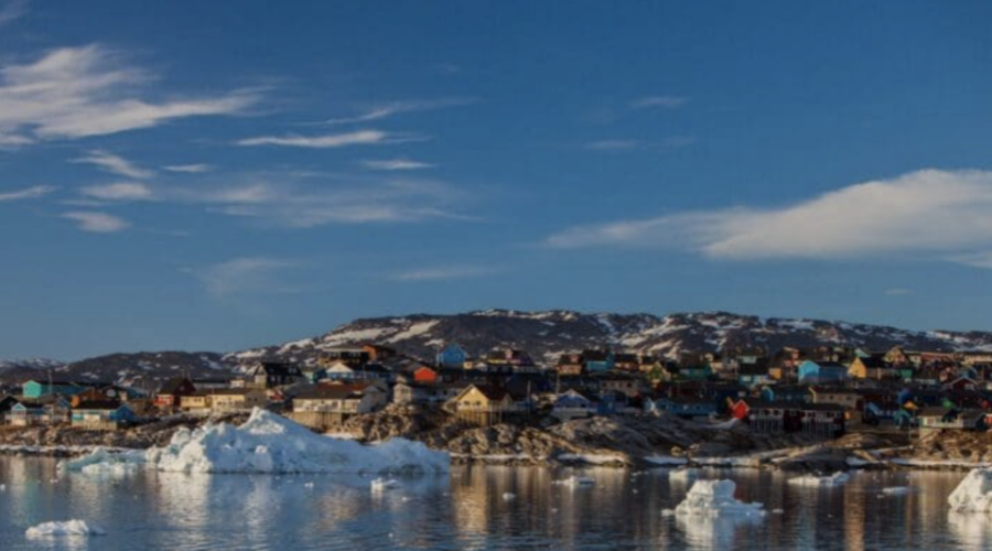
On certain Arctic mornings, the sky looks hollow, as if cold itself has a colour. In places like Nuuk or Ísafjörður, the air carries a taut stillness that forewarns a day when technology becomes more than a convenience. For decades, the Arctic was treated as a blind spot: a region too vast, too cold, too unlit in winter to be fully observed. Scientists used to joke, a little bitterly, that the list of what humanity didn’t know about the Arctic was more thoroughly measured than the list of what it did.
But over the last few years, a quiet revolution has begun.
Not a revolution driven by geopolitics or grand speeches in conference halls, but by flight paths, camera lenses, methane sensors, and hydrophones, each no larger than a hand but carrying the weight of Arctic insight. The new Arctic toolkit, if you were to lay it out on a table, would not look like a set of heroic instruments. It would resemble a scattered assortment of machines: compact drones in insulated cases, satellite prototypes on engineers’ benches, and ocean-floor pods waiting for deployment into the dark.
The transformation is happening not because the Arctic is suddenly more accessible, but because the world has finally acknowledged that what happens at the top of the planet is inseparable from everything elsewhere. Ice melt, methane bursts, coastal erosion, shipping accidents, these are no longer distant marginalia. They are global signals.
And increasingly, they are being read not by humans on the ground, but by machines in the air, in orbit, and deep underwater.
The Drone That Sees What Helicopters Cannot
On a wind-burnished afternoon in Nuuk, Greenland, a team of researchers launched two drones from what locals jokingly call “the world’s end”, a headland that juts into the city’s fjord like a punctuation mark. The drones were part of a 2025 pilot study run by the University of Southern Denmark and the Alexandra Institute, supported by Denmark’s National Defence Technology Centre, designed to test whether commercial, off-the-shelf drones could extend the reach of Arctic search-and-rescue (SAR) operations.
They were not looking for anything mythical. They were looking for people.
In one simulation, a researcher lay flat against a rocky outcrop, mimicking a hiker injured in sudden fog. In another, a volunteer walked slowly along the shoreline to test whether AI-assisted recognition could detect motion under poor lighting. The drones catalogued every pose, every shift in silhouette, building the training data needed for machine-learning models that SAR helicopters could one day rely on.
Why drones? Because in the Arctic, minutes cost lives. Helicopters cannot always rise in time. Fog can swallow visibility. Fjords can funnel winds into violent crosscurrents. The World Economic Forum reported that Arctic maritime traffic has increased by more than 37% since 2013, with total sailing distances more than doubling. Winter sailing time, once marginal, has tripled.
More ships. More hikers. More tourism.
And more need for eyes that can launch in seconds, navigate where humans cannot, and observe from angles no helicopter can manage without risk.
In an era of retreating sea ice and expanding activity, the Arctic is being asked to support a level of traffic it was never built to withstand. Drones, then, are no longer fringe tools. They are the first responders’ new companions, designed not to replace crews but to keep them from flying blind into the teeth of a storm.
When Drones Become Scientists
Rescue is only one of their jobs. Increasingly, drones have become field scientists, sentinels, and even scribes of a changing climate.
In early 2026, the French company Azur Drones revealed that its Skeyetech autonomous drone system had been adapted for the European MISO project, a Horizon‑funded scientific effort to better understand greenhouse gas emissions in Arctic and boreal environments.
Originally designed for industrial surveillance, Skeyetech was retrofitted into a scientific platform carrying methane-detection payloads, long-range communications, and insulation suitable for Arctic humidity and sub‑zero temperatures. To get it ready required not just coding but mechanical engineering, sensor integration, LoRa-network adaptation, and regulatory navigation across Norway and Finland. Researchers needed to know not whether drones could fly at −20°C (that was already established) but whether they could carry sensitive gas-imaging instruments and maintain reliable data links in remote terrain where no cell tower exists.
The MISO team’s goal was not surveillance but science: collect high-resolution methane flux data to help interpret satellite observations and refine climate models. And in many ways, drones have become the Arctic’s handwriting. They can skim across wetlands, fly beneath cloud cover, hug coastlines, and revisit the same coordinates again and again with a precision that human fieldwork struggles to match.
Methane leaks from permafrost thaw, subtle shifts in vegetation, the contours of erosion, all of these become visible through repeated passes at the same altitude, same angle, same resolution. Drones, unlike satellites, can notice the difference between a patch of moss and a patch of mud. In the Arctic, that difference matters. Moss traps heat. Mud releases it.
The Citizen Rangers of the North
But the most startling innovation is not technological, it is social.
In Northeast Iceland and South Greenland, an unusual partnership has formed between scientists and local residents through the ICEBERG project (2024–2026). Using a mix of time-lapse cameras, drones, and an open mapping platform, ICEBERG trains community members to become citizen scientists, capable of flying drones, collecting imagery, and annotating marine litter across inaccessible coastlines.
It started with 14 time-lapse camera systems installed with help from residents, NGOs, and community groups. These cameras continuously captured coastal images that were fed into AI models for automated litter detection. Soon, residents themselves were flying drones over beaches, documenting erosion patterns and collecting data for machine-learning algorithms. By the end of 2024, over 200 citizen-generated entries had been added to the Coastal Marine Litter Observatory.
In many ways, the ICEBERG project represents the Arctic’s future: a fusion of local knowledge and cutting-edge technology that distributes scientific authority rather than concentrating it in visiting research teams.
The Arctic is too large, too complex, and too energetic to be monitored by elite institutions alone. It requires networks of people who know the coastline from childhood, who understand the rhythms of tides and storms, and who can slip a drone into flight just minutes after debris or pollution washes ashore. The Arctic’s next generation of monitoring, it appears, will be community-driven, drone-supported, and AI-enhanced.
A Sky That Watches Back
Drones handle the “small” scale, beaches, crevices, fjord walls. But for the Arctic to be understood, the air must be listened to from higher up. The next layer in the observational stack is orbit.
Although we’ll explore satellites in depth further down below, it’s important to see how drones serve as the ground truth that satellites cannot always provide. Satellites see the broad strokes: ice melt patterns, atmospheric methane, storm systems, but they struggle with fine detail due to cloud cover, polar night, and the limitations of orbital geometry.
That is why so many drone missions today are explicitly tied to satellite calibration:
- The MISO drones gather methane data to validate satellite greenhouse gas measurements.
- ICEBERG drones produce high-resolution coastal imagery that helps interpret spectral data collected by orbiters.
- Search-and-rescue drones in Nuuk test AI recognition models that may someday be integrated with satellite-alert systems for emergency response.
Drones are the field instruments; satellites are the chroniclers. Between them lies the beginning of a network that scientists have dreamed of for decades: a pan‑Arctic, multi-platform observing system as coordinated as Europe’s weather satellites but tailored to the unique physics of polar regions.
The Arctic is no longer unseen. It is becoming hyper-seen, an environment in which machine vision fills the gaps that human presence cannot. But while eyes in the sky are multiplying, they are still only one layer.
Below the ice lies the final piece of the Arctic observational puzzle, the seafloor.
Orbit, Ice, and the Listening Deep
Long before a drone can shiver into flight, satellites are already watching.
From far above the curvature of the Earth, the Arctic holds a strange gravity, not the physical kind, but the gravitational pull of consequence. The Arctic Observing Mission, led jointly by the Canadian Space Agency and Environment and Climate Change Canada, represents one of the most ambitious attempts yet to see the Arctic in ways that science has only imagined until now: with two spacecraft designed to observe the region more frequently and in more detail than existing satellites allow.
The mission’s philosophy is simple: you cannot protect what you cannot see.
Satellite imagery has always had an intimacy problem when it comes to the Arctic. Clouds blanket coastlines for days. Polar night erases visible‑light sensing entirely. Snow and ice share spectral signatures that confuse conventional imagers. And coverage gaps mean that by the time a satellite passes overhead again, the landscape may have changed, ice fractured, methane flared, meltwater pooled, a storm front rearranged the sky.
The Arctic Observing Mission would change that.
According to CSA scientists, the mission could dramatically improve weather forecasts, air-quality monitoring, and greenhouse-gas detection, especially through its planned Fourier transform spectrometer capable of measuring CO₂, methane, and carbon monoxide with unprecedented resolution.
To people in northern communities, this isn’t technical minutiae. Better forecasts mean safer travel on sea ice, more reliable planning for hunting and fishing, and earlier warnings for storms that hit harder every year.
Satellites, then, are not aloof observers. They are instruments of safety.
But even they need partners closer to the ground, drones in particular, to validate and sharpen their view. That is why methane‑tracking drones from the MISO project were explicitly designed to strengthen the interpretation of greenhouse‑gas satellite data.
It is why ICEBERG’s coastal drone flights help calibrate spectral signatures for marine debris.
In the new Arctic observing architecture, satellites provide the broad view, drones offer the close view, and the seafloor, still the least understood frontier, supplies the long memory.
The Sea Holds Its Breath
To understand the Arctic fully, you must go beneath it. The ocean under the ice is a world with its own time signature: slow, dark, seasonal, and largely inaccessible. For decades, oceanographers have battled a stubborn truth, there are severe gaps in in‑situ Arctic ocean data, not for lack of curiosity, but because conditions are so hostile that sustaining year‑round measurements is nearly impossible. A recent NOAA assessment highlights that sparse observing systems, insufficient sensors, and interrupted satellite continuity leave the Arctic Observing Network (AON) at risk, despite its essential role in tracking climate shifts.
The open secret among polar researchers is that we know the Arctic Ocean least where it changes most.
Storms are more frequent.
Sea ice is thinner.
Warming penetrates deeper.
Ecosystems respond in non-linear fits and starts.
To map these transformations, researchers need machines that can survive where humans cannot.
Machines Left in the Dark
In a conference room in Boulder, Trondheim, or Tromsø, the exact location hardly matters; the conversations repeat across the circumpolar world, ocean technologists gather around tables to plan the future of Arctic seafloor observation. Their tools look like props from quiet science fiction: fixed seafloor observatories, long-duration moorings, gliders, AUVs, ROVs, benthic crawlers, and arcane acronyms like arcFOCE, a deep-water experimental system used to study the effects of ocean acidification on benthic communities.
Projects like INTAROS in the Fram Strait and Svalbard fjords now deploy:
- Passive acoustic systems to monitor marine mammals and human-generated underwater noise
- Autonomous sensors measuring pCO₂, pH, alkalinity, and dissolved carbon
- Experimental units to simulate future ocean chemistry
Each device must endure:
high pressure, corrosive water, low temperatures, biofouling, ice hazards, and the risk of entanglement or destruction by fishing gear.
Seafloor observation is not a tranquil discipline. It is a test of endurance, both for the machines and the scientists. Yet despite the challenges, new frameworks are emerging.
The ASSW 2025 Ocean Observation session emphasized the need for tightly integrated, autonomous sensor systems deployed across the seafloor, water column, sea ice, and atmosphere, a network that can operate year-round without human supervision.
In other words: The Arctic must be listened to continuously, not seasonally.
An Ocean That Speaks in Many Frequencies
Seafloor sensors produce data that satellites cannot replicate: the sound signatures of melting glaciers, the groan of shifting ice keels, the quiet percussion of beaked whales, the pH drift of acidifying waters, the arrival of warm Atlantic currents.
These observations complement the spectacular breadth of the Ocean Observatories Initiative (OOI), a global network of more than 900 instruments delivering real-time ocean data across multiple arrays. The OOI is not limited to polar regions, but its inclusion of the Global Irminger Sea Array, near Greenland, makes it a critical node for North Atlantic circulation monitoring.
OOI’s mission (sustained, open-access ocean data) aligns with what Arctic networks now demand: visibility, continuity, transparency, and redundancy.
Taken together, INTAROS, OOI, coastal moorings, ice-tethered profilers, and seafloor platforms form the submerged layer of a monitoring mesh that is steadily tightening around a once-dark ocean.
It is no exaggeration to say that the Arctic Ocean is being mapped with a granularity unimaginable even a decade ago, but only if investment persists. As NOAA warns, the resilience of the entire Arctic Observing Network depends on sustained funding, interagency coordination, and the protection of specialized expertise, none of which can be taken for granted.
The New Constellation: Drones, Satellites, Sensors
When you put all the pieces together, drones on fjord edges, satellites in polar orbit, seafloor sensors blinking quietly in the dark, a pattern emerges.
The Arctic is becoming one of the most instrumented regions on Earth.
Not in the sense of surveillance, but in the sense of care, a global act of attention.
The technologies now deployed are not extractive. They are observational, diagnostic, and precautionary.
A drone flying over a Greenland fjord during a methane-measurement run is not simply collecting data; it is grounding climate models.
A citizen scientist launching a small quadcopter from a beach in Northeast Iceland is not merely taking pictures; she is training an AI to recognize plastic shifted by a storm.
A satellite measuring CO₂ above Nunavut or Svalbard is not just producing maps; it is warning us where feedback loops may accelerate.
A seafloor pH sensor in Fram Strait is not just recording chemistry; it is telling us how fast the ocean’s buffering capacity is weakening.
The Arctic once seemed too remote to understand. Now, paradoxically, it may soon become the place we understand best, not because it has become less hostile, but because we have finally built the tools that the region demands.
The Fragile Grid That Holds It All Together
But there is a risk woven through this progress. Observation requires continuity.
And continuity requires funding, political stability, and international cooperation.
The Arctic Observing Network has already highlighted vulnerabilities: the risk of losing satellite coverage, the fragility of specialized sensor manufacturing, the difficulty of maintaining autonomous systems in freezing conditions.
The High Arctic Ocean Observation System (HiAOOS), funded by Horizon Europe, attempts to address this by building an integrated, multinational infrastructure stretching from Norway to Greenland.
But even this project, huge in scope and budget, depends on the long-term political will of governments navigating competing priorities.
In a shifting geopolitical climate, with Arctic shipping lanes drawing new attention, military actors racing for cold‑weather drones, and major powers debating resource rights, the continuity of scientific cooperation cannot be assumed.
NATO countries, for instance, are racing to develop drones that can survive −40°C conditions after field failures, as strategic importance intensifies.
The new Arctic toolkit exists at the intersection of science, security, and climate necessity.
Its future relies on all three realms maintaining enough cohesion to keep the instruments running.
The North, Newly Visible
In Ísafjörður, as evening settles into the fjord, a drone lifts from a dockside platform.
It climbs into the weak light, pivots north, and begins a programmed route along the coastline.
Nearly simultaneously, hundreds of kilometres above, an orbiting satellite sweeps over the same latitude, capturing thermal and spectral data.
And deep below, in a trench where sunlight has not touched for millennia, a pCO₂ sensor logs another line of numbers to a file that will, days later, surface on a researcher’s screen.
None of these machines will meet.
None know of the others’ existence.
But together, they form a new kind of seeing, a layered, integrated, multi‑modal vision that stretches from seafloor to sky. A vision built not from heroics but from the patient accumulation of data points, flight plans, orbital paths, and acoustic logs.
The Arctic, long treated as a silence, is now speaking in many frequencies.
And for the first time, we have the tools to listen.